MS-6222X High precision MEMS integrated navigation system

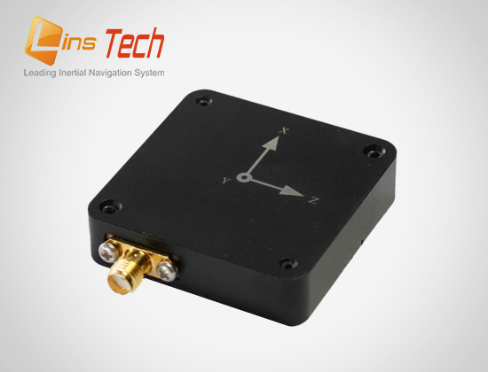
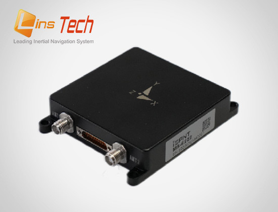
MS-6222X is a miniaturized high-precision MEMS integrated navigation system independently developed by LINS Technology. It is equipped with a self-developed high-precision MEMS IMU (Inertial Measurement Unit) and a self-developed high-precision GNSS module, and uses multi-source Kalman filtering fusion algorithm to provide continuous and reliable high-precision positioning and navigation information in complex environments. The product is widely used in fields such as unmanned aerial vehicles, surveying and mapping, stable platforms, and satellite communication.

关键词:

Category:

key word: MS-6222X High precision MEMS integrated navigation system

Details

MS-6222X is a miniaturized high-precision MEMS integrated navigation system independently developed by LINS Technology. It is equipped with a self-developed high-precision MEMS IMU (Inertial Measurement Unit) and a self-developed high-precision GNSS module, and uses multi-source Kalman filtering fusion algorithm to provide continuous and reliable high-precision positioning and navigation information in complex environments. The product is widely used in fields such as unmanned aerial vehicles, surveying and mapping, stable platforms, and satellite communication.

Main features:

√High reliability of product design, scientific and effective product research and development

√ Professional and perfect production equipment, strict quality control of the production process

√Deliver better products to your users

√Years of industry deep application experience, super thousand industry users practical cases

√ Industry-leading compensation calibration technology, efficient and rapid professional technical response

√ Provide more satisfactory service for users

▪ Support BDS, GPS, GLONASS, Galileo, and QZSS full system multi frequency points, and support the Beidou three satellite system

▪ All IMUs have undergone factory level temperature and dynamic calibration

▪ Optimized SWaP-C design, miniaturized and multifunctional

▪ Support multiple alignment methods such as transfer alignment and dynamic alignment

Typical applications:

1

Specification parameters:

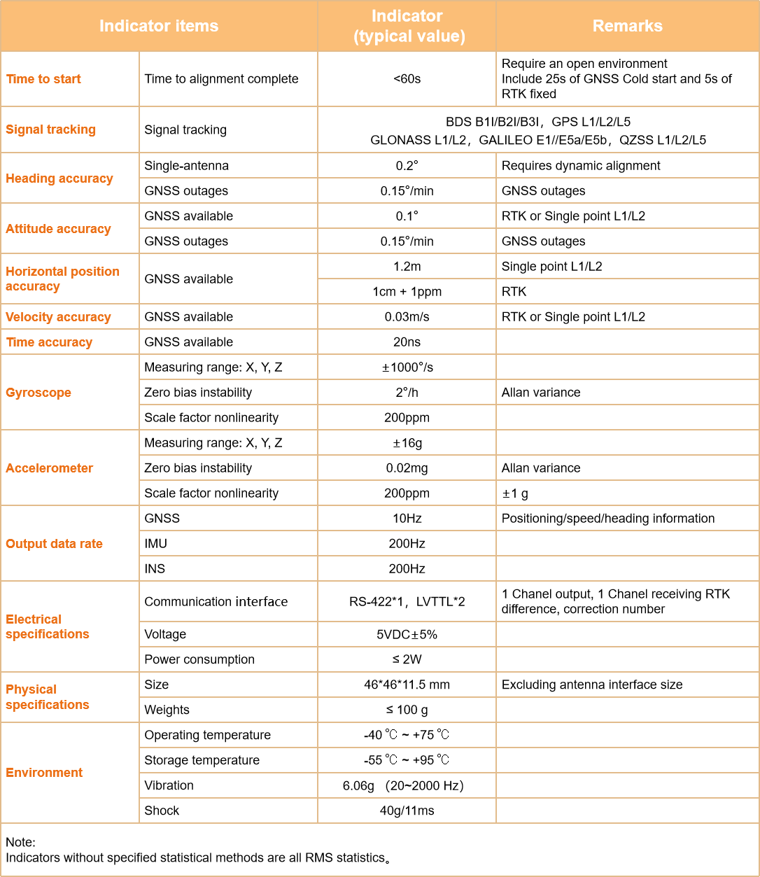
Indicator items

Indicator
(typical value)

Remarks

Time to start

Time to alignment complete

<60s

Require an open environment
Include 30s of GNSS Cold start and 5s of RTK fixed

Signal tracking

Signal tracking

BDS B1I/B2I/B3I ,GPS L1/L2/L5
GLONASS L1/L2 ,GALILEO E1//E5a/E5b ,QZSS L1/L2/L5

Heading accuracy

Single-antenna

0.2°

Requires dynamic alignment

GNSS outages

0.15°/min

GNSS outages

Attitude accuracy

GNSS available

0.1°

RTK or Single point L1/L2

GNSS outages

0.15°/min

GNSS outages

Horizontal position accuracy

GNSS available

1.2m

Single point L1/L2

1cm + 1ppm

RTK

Velocity accuracy

GNSS available

0.03m/s

RTK or Single point L1/L2

Time accuracy

GNSS available

20ns


Gyroscope

Dynamic measuring range: X, Y, Z

±1000°/s


Zero bias instability

2°/h

Allan variance

Scale factor nonlinearity

200ppm


Accelerometer

Dynamic measuring range: X, Y, Z

±16g


Zero bias instability

0.02mg

Allan variance

Scale factor nonlinearity

200ppm

±1 g

Output data rate

GNSS

10Hz

Positioning/speed/heading information

IMU

200Hz


INS

200Hz


Electrical
specifications

Communication ports

RS-422*1 ,LVTTL*2


Input voltage

5VDC±5%


Power consumption

≤ 2W


Physical
specifications

Dimensions

46*46*11.5 mm

Excluding antenna interface size

Weights

≤ 100 g


Environment

Operating temperature

-40 ℃ ~ +75 ℃


Storage temperature

-55 ℃ ~ +95 ℃


Vibration

6.06g ( 20~2000 Hz)


Shock

40g/11ms


Note:
Indicators without specified statistical methods are all RMS statistics;
The 231012 firmware and later versions support up to 200 Hz, while the 231012 firmware previously supported up to 100 Hz.

Inquiry

We will contact you within one working day. Please pay attention to your email.

Submit

Recommended products